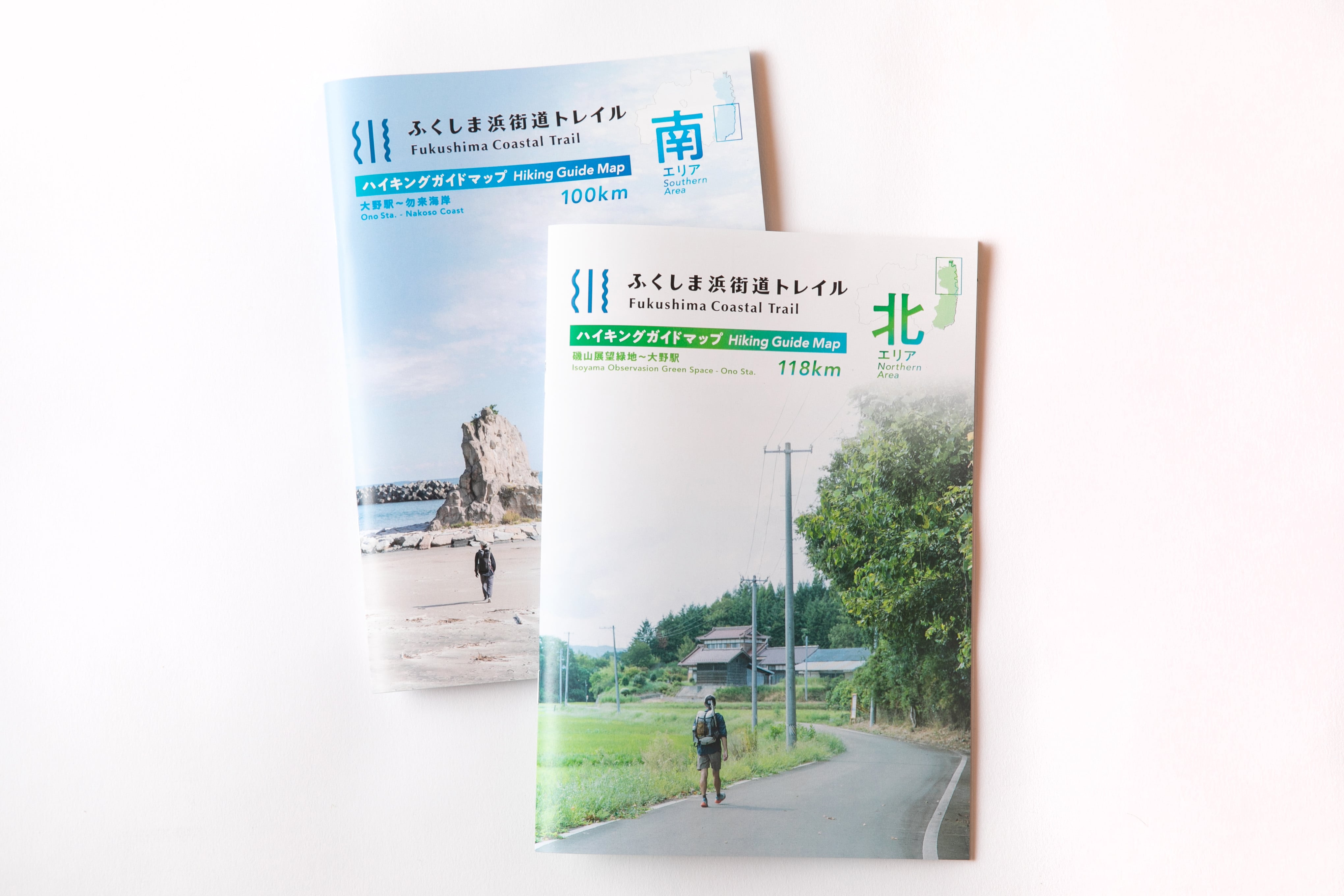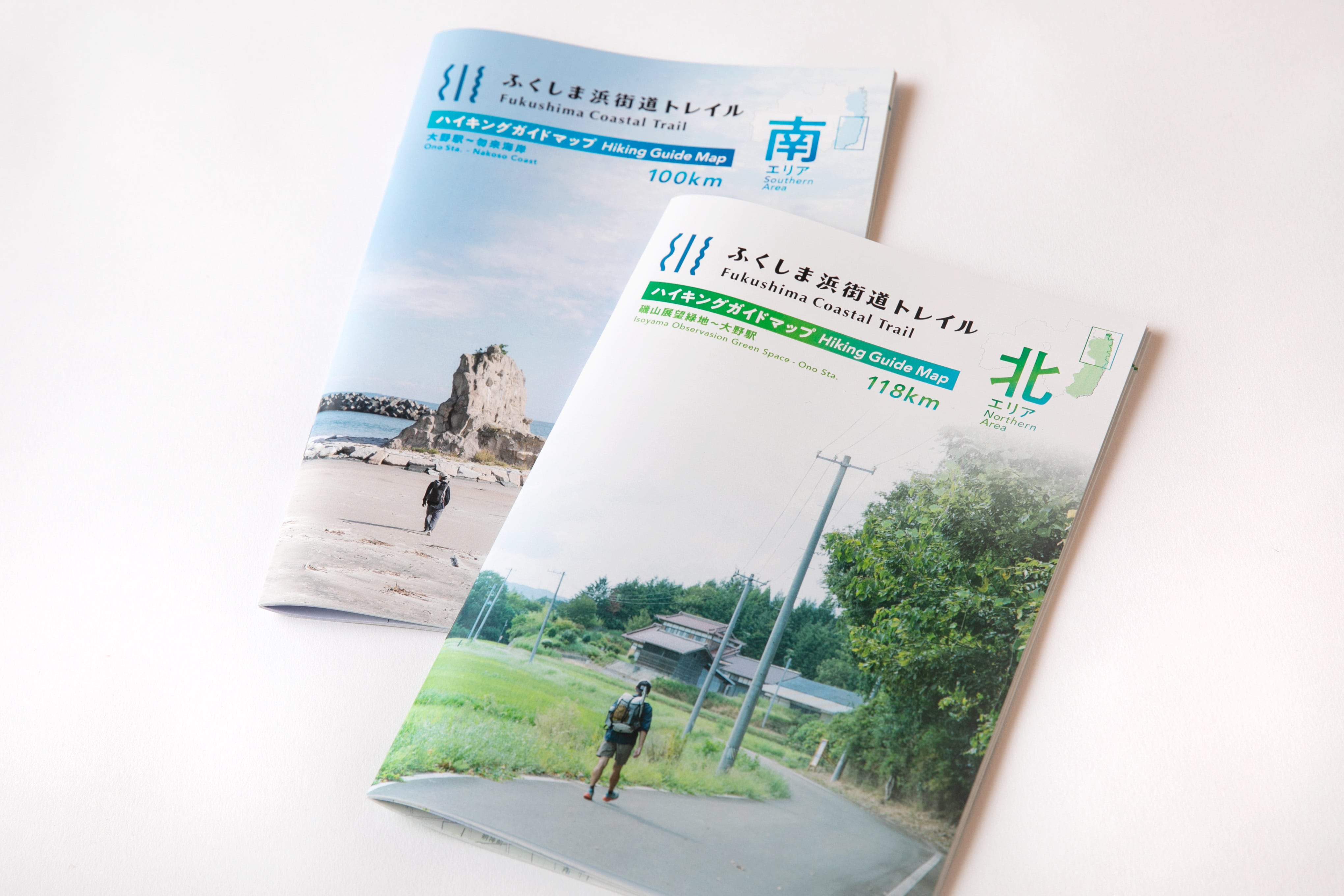


【北南2冊セット】ハイキングガイドマップ/North,South Hiking Guide Map Set
¥3,740($23.60)
International shipping available
【 ※ 重要:2冊セット購入専用ページです】
ハイキングガイドマップは「ふくしま浜街道トレイル(FCT)」を歩くために欠かせないルート情報をコンパクトにまとめました。「どこから歩こう?」「今日はどこまで行こう?」「この先には何がある?」、そんな歩く前の計画から、実際にトレイルを歩いている最中まで、常に手元で旅をサポートしてくれる、ハイカー必携のガイドマップとなっています。
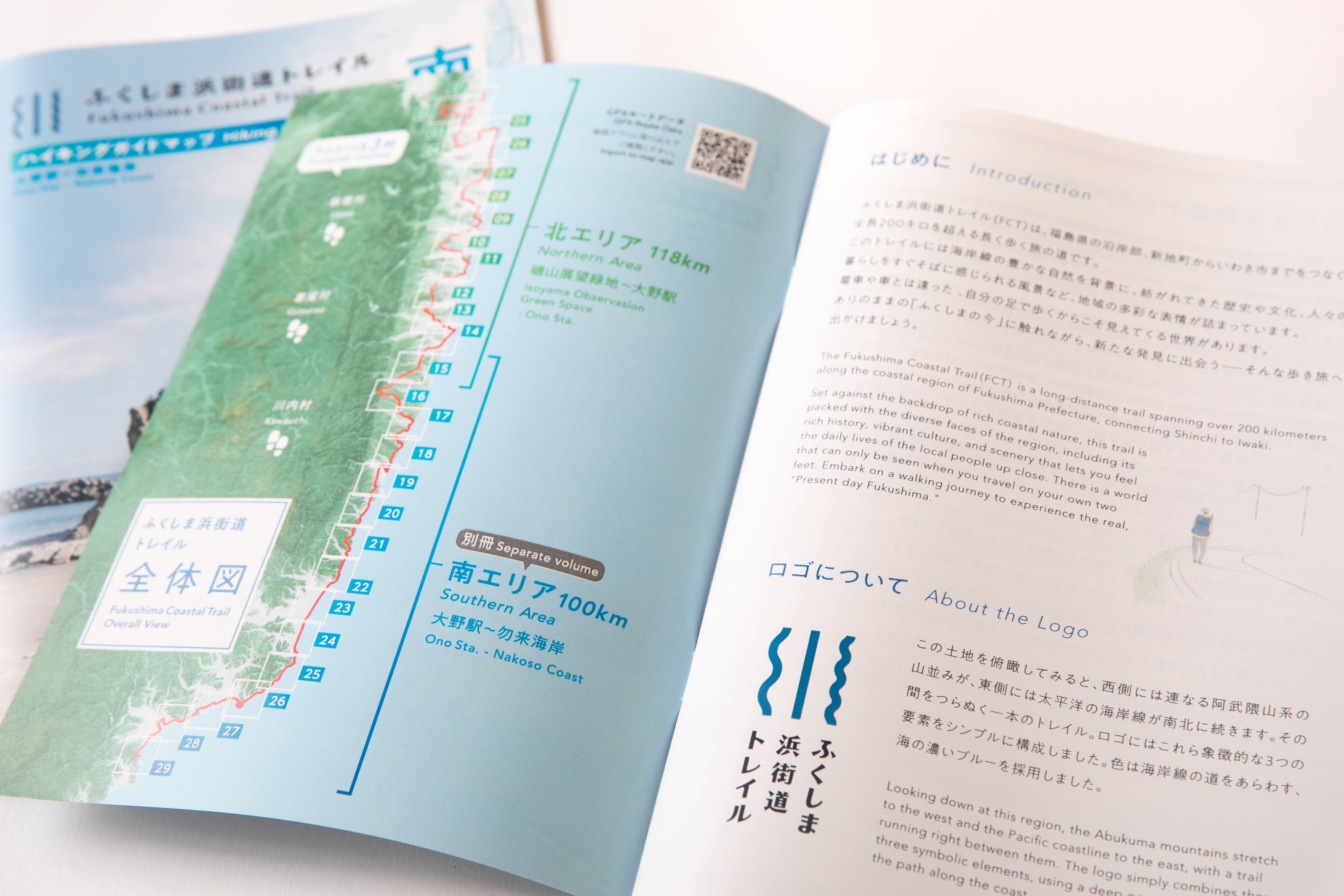
全長220kmのFCTを「北エリア(磯山展望緑地公園~大野駅)」と「南エリア(大野駅~勿来海岸)」に分けた2冊の構成になります。ガイドマップとしての詳細の情報を掲載しながら、できる限りページ数を抑え、ハイカーが携帯しやすいサイズ感を心掛けています。
■歩く前の「計画」が立てやすい
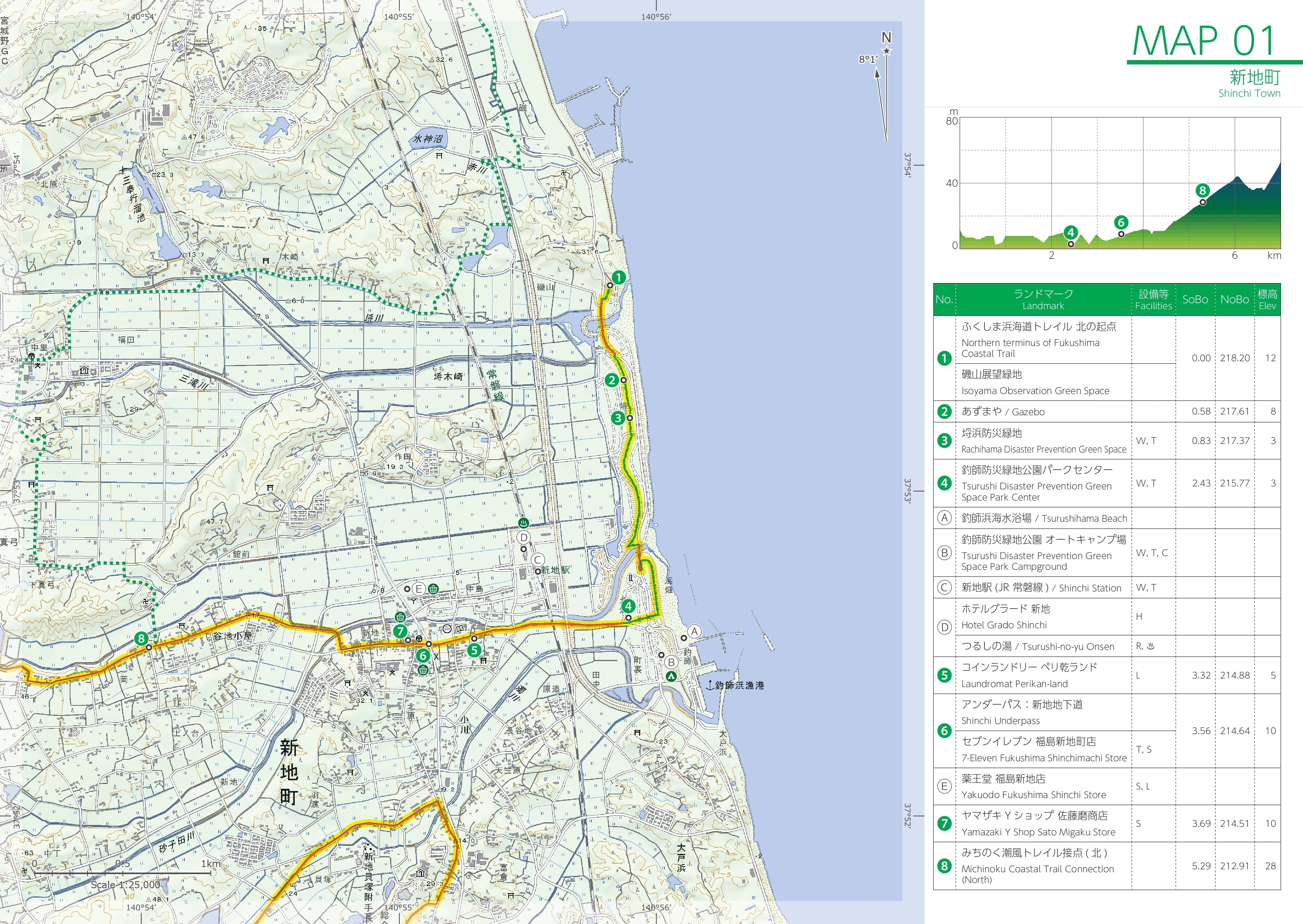
南向き・北向きそれぞれのルート距離に加え、標高やランドマーク間の距離を確認できるほか、水場、トイレ、宿泊施設、キャンプ場、商店など、ハイキング中に必要となる施設情報をアイコンでわかりやすく紹介しています。さらに、実際の歩き方をイメージしやすい「セクションハイキング参考例」も掲載。200kmを超えるFCTを一度に歩くことも、「まずはこの区間を歩いてみよう」と、自分に合った区間から気軽にハイキングを始めることもできます。
■歩いているときの「安心」をサポート
FCTは比較的歩きやすいトレイルのため、FCTで初めてハイキングを経験する方もいるかもしれません。初めての方に向けて(もちろん経験者にも改めて)、ハイキングを歩くうえで最低限知っておいてほしい情報や不可欠な装備情報を掲載しました。
万が一の時に役に立つ情報も掲載しています。トレイルに関する問い合わせの窓口や、医療機関・交通機関の情報を日英併記で掲載。緊急時に必要な連絡先を一覧で確認することができます。
また、ルート上の注意箇所もアイコンで表示。あらかじめ注意が必要な場所を把握することで、安全に歩くための準備にも役立ちます。
■歩きながら「ふくしまの今」を知る
ルート情報の他に、地域にゆかりのある方や歴史の専門家によるコラムを掲載。地域で暮らす人々の言葉を通して、風景や場所の背景を知ることは、地域の理解を深め、歩く体験を豊かにしてくれます。
ただ目的地を目指して歩くのではなく、道の先にある地域の暮らしや歴史、営みに目を向ける。「歩く」ことをきっかけに、浜通りの自然だけでなく、そこに暮らす人々や地域の「今」に出会うことができます。
・ページ数:48P
・サイズ:A5
・種類:北エリア、南エリア
・重さ:65g(一冊分の重さ)
売り上げはトレイルの管理・運営に活用させていただきます。
This hiking guide map is an essential companion for exploring the Fukushima Coastal Trail (FCT), bringing together key route information in a compact and easy-to-carry format.
“Where should I start walking?”
“How far should I go today?”
“What will I find along the way?”
From planning your hike to navigating the trail itself, this guide map is designed to support you throughout your journey.
The 220-km-long FCT is divided into two guidebooks: the Northern Area (Isoyama Observation Green Park–Ōno Station) and the Southern Area (Ōno Station–Nakoso Coast). While providing detailed information for hikers, each guide has been designed to keep the number of pages to a minimum and remain compact enough to carry comfortably on the trail.
■Easy Planning Before Your Hike
In addition to route distances in both the northbound and southbound directions, the maps show elevation and distances between landmarks. Essential facilities along the trail—including water sources, restrooms, accommodation, campgrounds, and shops—are clearly indicated with easy-to-understand icons.
The guide also includes sample section hikes, making it easier to visualize what a hike will actually be like. Whether you want to tackle the FCT's 200+ km route or simply start with a short section that suits your schedule and experience, the guide helps you plan your hike your way.
■Support for a Safe and Comfortable Hike
The FCT is a relatively accessible trail, making it an appealing option for people experiencing hiking for the first time. The guide provides essential information and recommended equipment that all hikers should know before setting out, while also serving as a useful refresher for experienced hikers.
Information that may be useful in an emergency is included as well. Contact information for the FCT, medical facilities, and transportation services is provided in both Japanese and English, allowing you to quickly find the numbers you may need in an emergency.
Potential points of caution along the route are also marked with icons. Knowing in advance where extra care may be required helps hikers prepare appropriately and enjoy the trail more safely.
■Discover “Fukushima Today” Along the Way
Beyond route information, the guide features columns written by people with connections to the region and experts in local history.
Learning about the background of a landscape or place through the words of people who live in the area can deepen your understanding of the region and enrich your hiking experience.
Rather than simply walking toward a destination, take time to notice the lives, history, and activities that unfold along the trail. Walking the FCT offers an opportunity to encounter not only the natural beauty of Hamadori, but also the people who live there and the region as it is today.
■Specifications
Pages: 48 pages
Size: A5
Type: Northern Area / Southern Area
Weight: 65 g per guidebook